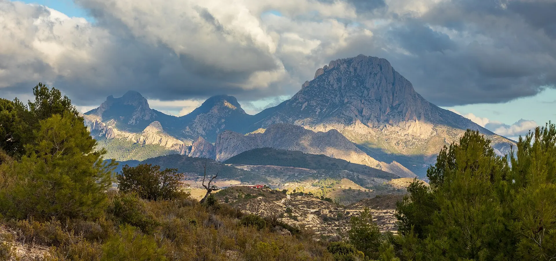
Sierra de Aitana: Sella and Confrides
Best Season
Cold with possible ice in winter above 800 m. Cool summers. Best in spring and autumn.
Climb to the Tudons mountain pass (1,024 m) crossing the Sierra de Aitana, the roof of Alicante. Technical roads, hidden villages and 360-degree panoramas from the summit.
Highlights
- 1Puerto de Tudons (1,024 m): the highest pass in Alicante
- 2Sierra de Aitana: highest point in the province (1,558 m)
- 3Sella: a village perched in the mountains
- 4Confrides and the Vall de Seta
About this route
The Sierra de Aitana is the highest point in the entire province of Alicante, with its main peak at an altitude of 1,558 metres, and it also forms the mountainous backbone that physically separates the Mediterranean coast from the inland valleys of Alicante. It is a limestone massif of remarkable proportions, with vertical cliffs on some slopes, relict beech forests in shaded areas and alpine meadows on the summits, and it preserves flora and fauna that are surprisingly alpine for a Mediterranean mountain range: plant species survive here that are found only on these limestone crags at the southernmost tip of Europe, such as the moonflower (Astragalus nevadensis) and the king’s crown (Saxifraga longifolia).
The Tudons Pass (1,024 m), where the CV-770 climbs from Villajoyosa towards the interior, is probably the highest and technically most interesting tarmac-surfaced mountain pass in the whole of the province of Alicante. The road winds its way for over 20 km of continuous ascent, passing first through Mediterranean pine forests on the lower slopes, then through scrubland on the mid-slopes, and finally through alpine meadows at the summit. The tarmac is well maintained by the Alicante Provincial Council (which takes particular care of this road due to its tourist value), and the bends are technical yet wide, perfect for a motorbike ride to remember. On clear days, the views from the top of the pass take in the entire Mediterranean, from Cabo de Sant Antoni in the north to Cabo de Palos in the south – a panorama that is second to none in the area.
Sella, the village where the climb begins, has a charming architectural feature: it is literally nestled in a hollow at the foot of the Sierra de Aitana, with white houses terraced at seemingly impossible levels that descend all the way to the bed of the central ravine. Its medieval town layout remains virtually intact, with alleyways so narrow that in some places two people cannot walk side by side. The 17th-century Baroque parish church and the remains of the 12th-century Moorish castle complete a picture that retains all the charm of Alicante’s mountain villages from before the tourist era.
Confrides, on the other side of the pass in the Vall de Seta, is probably the highest-altitude inhabited village in the whole of the province of Alicante (over 900 metres). It is tiny — with barely 250 winter residents — but it has a special charm: the air is noticeably cooler than on the coast, winters can be harsh (with occasional snowfalls that close the mountain pass for days), and the feeling of being in a forgotten corner of the world is absolute. Strolling through its empty streets at dusk, especially in autumn when the surrounding oak and kermes oak trees turn golden, is the sort of experience that makes the motorbike trip worthwhile.
Motorcycling tip: the Tudons Pass can be icy and snowy in the depths of winter (particularly January–February), so it’s best to check beforehand. The best time to visit is from March to November. Fill up in Villajoyosa at the start of the route: inland, there is only one reliable petrol station in Alcoy (to the north) and another in Cocentaina. For lunch, in Confrides, the Casa el Pollo restaurant serves traditional cuisine from the Alicante hinterland, using local produce (kid, game, mushrooms) at reasonable prices. And a tip: the optional detour to Puig Campana (1,408 m), partially accessible by motorbike from Finestrat, offers unforgettable views of the southern face of the Aitana and is one of the least-visited spots in the massif.
Route stops
Sella
Village
Village perched at the foot of the Sierra de Aitana.
Puerto de Tudons
Viewpoint
The highest mountain pass in Alicante at 1,024 m.
Confrides
Village
Village in the Vall de Seta at over 900 m.
Practical information
Weather
Cold with possible ice in winter above 800 m. Cool summers. Best in spring and autumn.
Traffic
Low traffic, especially on weekdays.
Fuel stops
Fuel stations in Villajoyosa and Alcoy.
Where to stay on this route
The towns this route passes through — useful for splitting it into stages or sleeping near the start. Book ahead in high season.
- SellaSee places to stay
- ConfridesSee places to stay
- VillajoyosaSee places to stay
Affiliate links: if you book through them, Nomadiq earns a small commission at no extra cost to you.
Related routes
Guadalest, Callosa and Tarbena
Valencian Community
Coll de Rates from Parcent
Valencian Community
Alcoy, Carrasqueta and Xixona
Valencian Community
Vall d'Ebo, Vall d'Alcalà and Castell de Castells
Valencian Community