Rif: Chefchaouen and the route of the blue mountains
Best Season
Frequent rain in winter. Extreme heat in summer. Better in spring and autumn.
Chefchaouen, the "blue city" of the Moroccan Rif, and a journey through the Rif mountains with Berber villages, cannabis valleys, centuries-old cedars and goat roads.
Highlights
- 1Chefchaouen: the ‘Blue City’ of the Rif
- 2The Rif Mountains: cedars, Berber valleys
- 3Tetouan: former Spanish Protectorate
- 414 km from Spain (Tarifa–Tangier ferry)
About this route
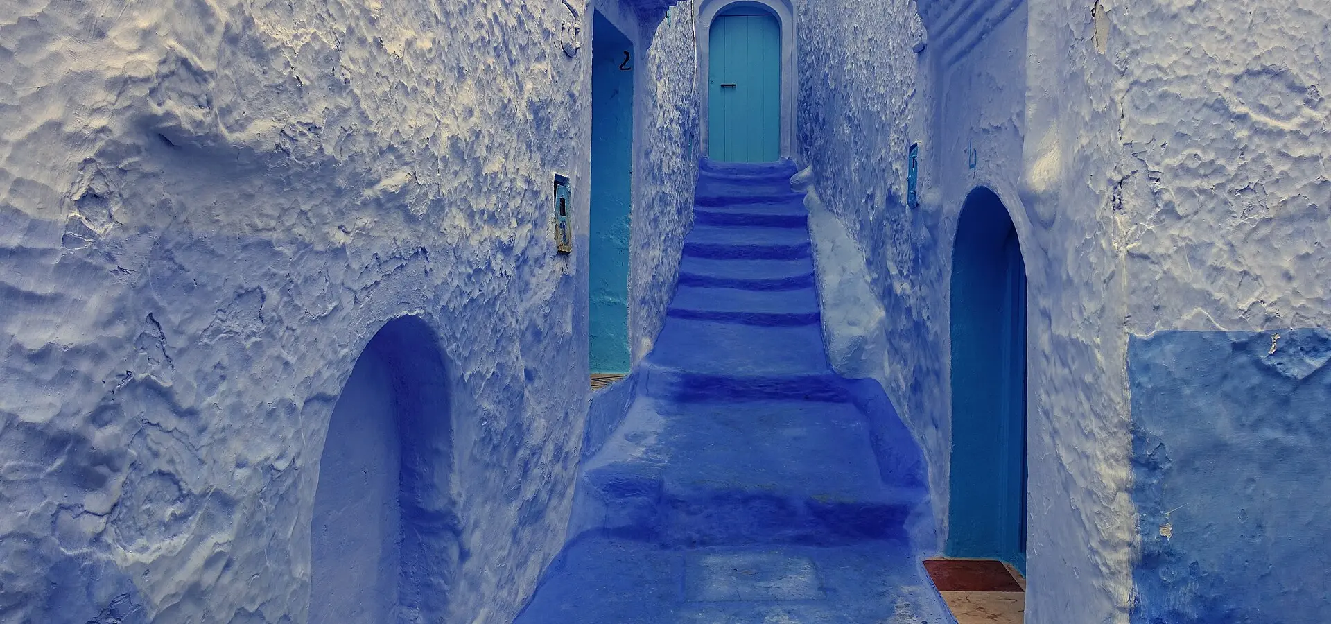
Chefchaouen is probably the most photogenic town in the whole of North Africa and, for a Spanish motorcyclist crossing the Strait for the first time, the initial visual impact is overwhelming. The entire medina — and much of the new town — is painted blue: sky blue, indigo blue, cobalt blue, woad blue, in a colour palette that has no equivalent anywhere else in the world. There are two popular explanations for the tradition of blue: the first is that it was the Sephardic Jews (expelled from Spain in 1492) who brought the custom of painting houses blue as a symbol of the sky and divine protection; the second maintains that blue repels mosquitoes, which are legion in these humid Rif mountains.
The Rif is probably the least well-known mountain range in the Maghreb among Europeans, despite being just 14 km from the Spanish coast. It is a rugged, green mountain range (which receives abundant Atlantic rainfall), covered in forests of cedars, holm oaks and pines, with deep valleys where Berber villages maintain a way of life that has scarcely changed over the centuries. The roads of the Rif are an adventure in themselves: the N2 and the R509 between Chefchaouen, Ketama and Al Hoceima are narrow and winding, with road surfaces of varying quality (excellent on the main stretches, in a terrible state on the side roads), and they cut through a landscape that, in many places, is strikingly reminiscent of the Alpujarras in Granada.
For Spanish motorcyclists, the route to the Rif has a special emotional significance: these are the landscapes that Spanish soldiers from the Protectorate saw during the Rif War (1921–1927), and even today one can still find bunkers, military roads and Spanish place-names in the mountains. The city of Tetouan, an hour’s drive from Chefchaouen, was the capital of the Spanish Protectorate for forty years and still boasts a colonial district with Art Deco buildings that are instantly recognisable to any Spaniard.
One sensitive issue worth mentioning: the Rif is the Maghreb’s main hashish-producing region, and in the valleys between Chefchaouen and Ketama, the cannabis fields are visible from the road. It is common for sellers to approach motorbikes at rest stops; the general advice is to decline politely and carry on. The Moroccan police carry out frequent checks in this area and foreign motorcyclists are always treated with courtesy, but it is advisable to ensure your documents are in order.
Motorcycling tip: Crossing into Morocco by motorbike from Tarifa (a 35-minute ferry ride to Tangier) or from Algeciras (ferry to Ceuta + land border crossing) is a relatively straightforward process. You’ll need a valid passport, the vehicle’s Carte Grise and Moroccan insurance (which you can buy at the port for €30–50 for a month). Driving in Morocco is very different to driving in Europe: watch out for donkeys, bicycles, pedestrians, slow-moving lorries and chaotic city traffic. Petrol stations are plentiful and cheap. For accommodation in Chefchaouen, Riad Lina is a restored traditional house with a terrace and views of the blue medina.
Route stops
Tetuán
Village
Medina UNESCO and Spanish colonial ensanche.
Chefchaouen
Village
The blue city of the Rif.
Akchour (cascadas)
Viewpoint
Rif waterfalls in the Talassemtane National Park.
Practical information
Weather
Frequent rain in winter. Extreme heat in summer. Better in spring and autumn.
Traffic
Chaotic traffic in cities. Mountain roads with poor signage.
Fuel stops
Frequent petrol stations in Morocco. Very cheap petrol.
Where to stay on this route
The towns this route passes through — useful for splitting it into stages or sleeping near the start. Book ahead in high season.
- TetuánSee places to stay
- ChefchaouenSee places to stay
- TangierSee places to stay
Affiliate links: if you book through them, Nomadiq earns a small commission at no extra cost to you.