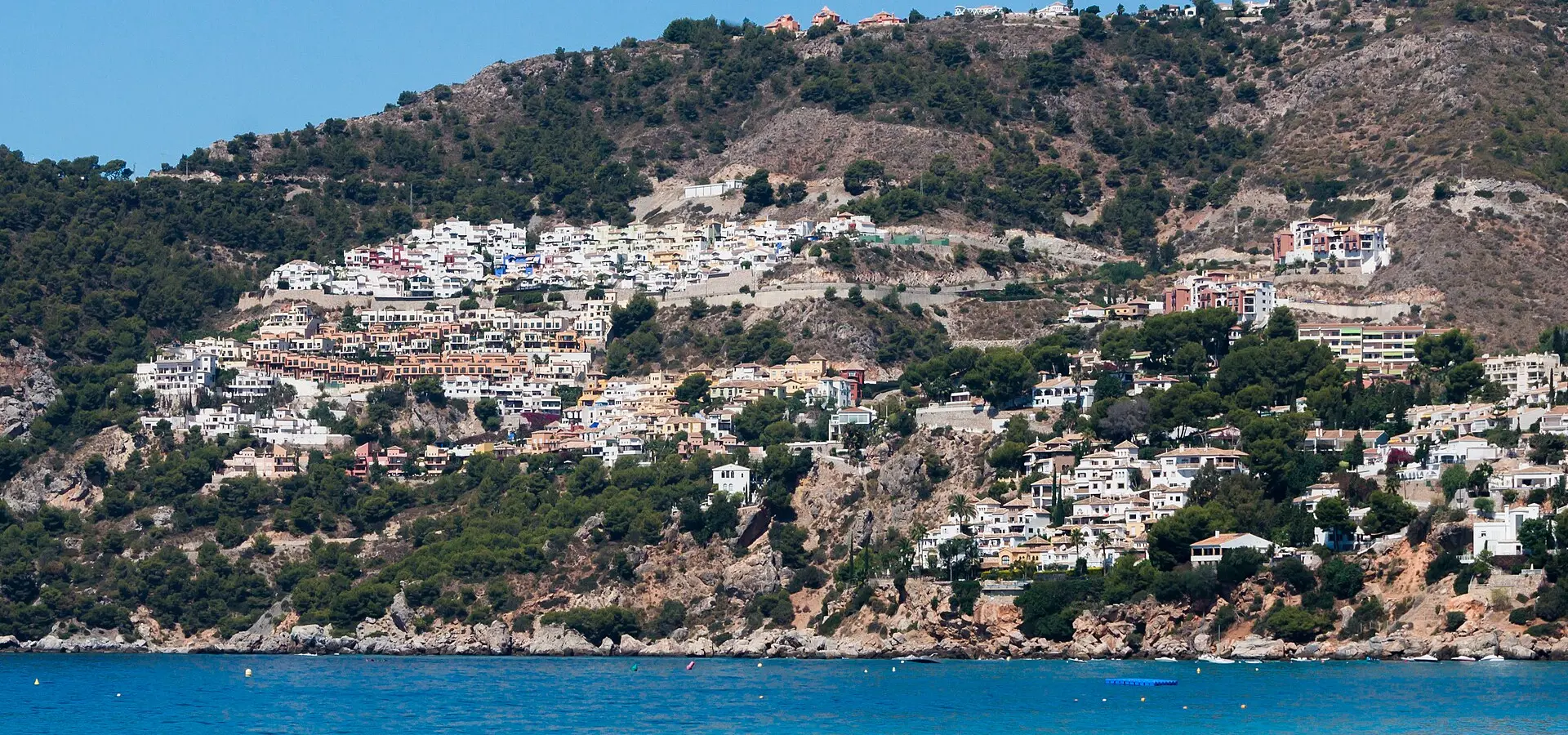
Costa Tropical: La Herradura and La Contraviesa
Best Season
Excellent all year round. Subtropical microclimate on the coast.
Costa Tropical and the climb to the Sierra de la Contraviesa: from the Mediterranean to the almond trees at altitude, with views of the Alborán Sea and the Moroccan Rif.
Highlights
- 1Costa Tropical: La Herradura, Almuñécar
- 2Sierra de la Contraviesa: a balcony overlooking the Mediterranean
- 3Views of the Moroccan Rif on clear days
- 4Almond trees in bloom in February
About this route
The Costa Tropical is one of the most apt names in Spanish tourism marketing, because it is literally true: this small stretch of coastline in Granada, between Salobreña and La Herradura, is the only area in mainland Europe with a strictly subtropical climate. Cherimoyas, mangoes, avocados, lychees, papayas and sugar cane are grown outdoors here, and many of the plantations are centuries old. The secret lies in the combination of the natural barrier formed by the Sierra Nevada, which blocks the cold northerly winds, and the Atlantic ocean current that flows in via Gibraltar and keeps the sea temperature at 18°C even in the depths of winter. The result is an average annual temperature of 19°C, identical to that of Cádiz but with a rugged mountainous landscape plunging down to the sea.
La Herradura, a sheltered bay shaped like a perfect semicircle, was, until twenty years ago, a well-kept secret amongst fishermen and divers. Its crystal-clear waters, south-facing position and the presence of Cerro Gordo right next to it have made it one of the best recreational diving spots on the peninsula, with visibility of up to 25 metres and a high level of Mediterranean biodiversity. The N-340 road that runs alongside it was for decades one of the most feared in Spain, with sharp bends along cliffs and poorly designed roundabouts; recent improvements have made it safer, but it retains all its biker charm.
The real hidden gem of this route, however, is not the coast but the climb up to the Sierra de la Contraviesa via the A-345 from Albuñol. This road climbs from sea level to 1,300 metres in just thirty kilometres, passing through a surreal landscape where almond trees and vineyards grow on slopes of up to 70 per cent on almost black, slate-like soil. La Contraviesa is Spain’s least well-known mountain range: an arid and solitary massif separating the Alpujarra from the Mediterranean, with forgotten little villages and roads where it is possible not to come across a single soul for a whole hour.
But what makes the trip worthwhile are the viewpoints at the summit of La Contraviesa. On clear days (and there are plenty of clear days here), from the Haza del Lino area you can see a panorama that is probably the most spectacular on the peninsula: at your feet, the deep blue Mediterranean; to the south, the peaks of the Moroccan Rif rising above the horizon like a ghostly mountain range ninety kilometres away; to the north, the silhouette of the Sierra Nevada with its peaks still snow-capped in the middle of May. It is the only place in Europe where you can see perpetual snow, the sea and another continent all at once.
When it comes to eating and sleeping, the area is delightfully low-tech: no international hotels here, just rural guesthouses and family-run restaurants where the dish of the day is traditional Alpujarra fare such as migas, remojón from Granada or chanfaina pork. Motorcyclists should bear one thing in mind: the climb up to La Contraviesa along the A-345 has narrow sections and a few spots where the road surface is visibly uneven; it’s best to ride with plenty of room to manoeuvre. The trick to making the perfect ride is to head up from Albuñol mid-morning, have lunch at a viewpoint overlooking the sea, and then descend the other side towards Torvizcón, linking up with the Alpujarras route if you have the time and energy.
Route stops
La Herradura
Village
Sheltered bay on the Costa Tropical.
Sierra de la Contraviesa
Viewpoint
Panoramic viewpoint over the Mediterranean.
Torvizcón
Village
Village in La Contraviesa known for its wines.
Practical information
Weather
Excellent all year round. Subtropical microclimate on the coast.
Traffic
Moderate traffic on the N-340. Low in the mountains.
Fuel stops
Petrol stations in Almuñécar, Motril and Albuñol.
Where to stay on this route
The towns this route passes through — useful for splitting it into stages or sleeping near the start. Book ahead in high season.
- La HerraduraSee places to stay
- TorvizcónSee places to stay
- AlmuñécarSee places to stay
Affiliate links: if you book through them, Nomadiq earns a small commission at no extra cost to you.
Related routes
Axarquía: Comares, Frigiliana and Málaga's Mudéjar Route
Andalusia
Sierra Nevada: Veleta and Alpujarras
Andalusia

Caminito del Rey, El Chorro and Antequera
Andalusia
Córdoba's Subbética: Zuheros and Priego
Andalusia