Lanzarote by motorcycle: La Geria, Timanfaya and the Famara cliffs
Best Season
A year-round route. AEMET normals (Lanzarote airport, 1981-2010): in January, an average high of 20.7 °C, an average low of 14.0 °C and 3.2 days of rain; December is the wettest month, with 29 mm. Check the wind forecast rather than the rain, especially for the Famara ridge and the north.
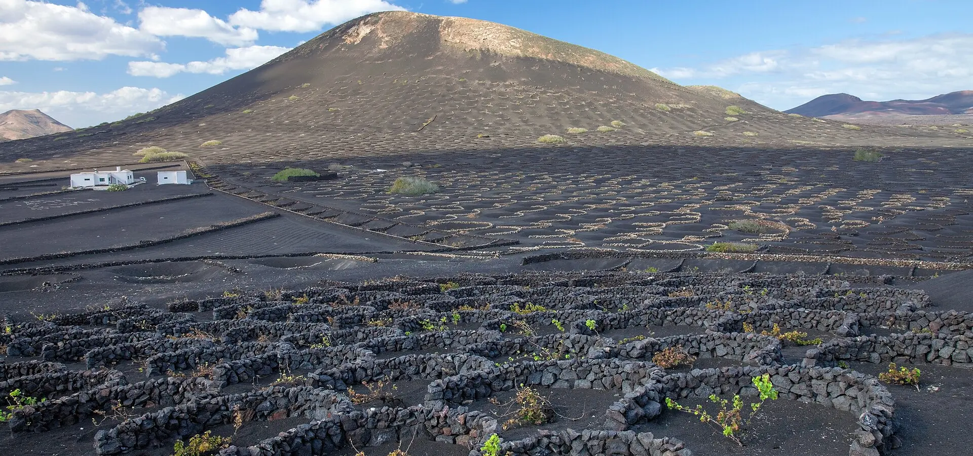
A one-day loop of Lanzarote from Arrecife: the pit-grown vines of La Geria, the LZ-67 across Timanfaya, Teguise, the palm groves of Haría and the Mirador del Río above La Graciosa.
Published on
Highlights
- 1La Geria: vines grown in pits of volcanic ash
- 2LZ-67: the road across Timanfaya
- 3Teguise, capital of Lanzarote until 1847
- 4Mirador del Río (César Manrique, 1973)
About this route
Lanzarote can be ridden end to end in a single day, and in January it is one of the few places in Spain where you can do it in short sleeves. From Arrecife, the LZ-30 enters La Geria, a protected landscape of volcanic ash where every vine grows in a hand-dug pit, sheltered from the wind by a semicircular stone wall. The ash comes from the eruptions that began on 1 September 1730 and shaped the landscape of Timanfaya.
Beyond Yaiza, the LZ-67 crosses Timanfaya National Park between lava flows and volcanic cones. Tickets for the Montañas del Fuego, at the Islote de Hilario, are sold online only, for a set day and time, on the website of the Cabildo's Centros de Arte, Cultura y Turismo. If you would rather not be tied to a slot, the Mancha Blanca Visitor Centre, on the same road, explains the eruptions and opens daily from 9:00 to 16:00.
Next to the centre stands the hermitage of Los Dolores, the Virgin of the Volcanoes and patron saint of Lanzarote. Tinajo town council records the tradition: in 1824, with a volcano erupting between Tao and Tiagua, the villagers carried the statue out in procession and the eruption stopped. From Tinajo the route drops to Caleta de Famara, at the foot of the cliffs, and climbs back to Teguise, the island's capital until 1847.
The last stretch is the best riding of the day: the LZ-10 climbs north and winds down to Haría, the palm-grove village where César Manrique lived from 1988 until his death in 1992. At the very top, the Mirador del Río, conceived by Manrique and opened in 1973, looks out from the top of the Risco de Famara over the El Río strait and La Graciosa. The ride back to Arrecife follows the LZ-1 down the east coast.
Route stops
La Geria
Viewpoint
Protected landscape of vines planted in pits of volcanic ash and sheltered by low stone walls.
Yaiza
Village
Head town of the municipality that holds most of Timanfaya; the LZ-67 into the national park starts here.
Mancha Blanca Visitor Centre (Timanfaya)
Museum
Timanfaya National Park centre on the eruptions; open daily from 9:00 to 16:00. The Los Dolores hermitage is next door.
Tinajo
Village
Village of the municipality that Mancha Blanca and the hermitage of Lanzarote's patron saint belong to.
Caleta de Famara
Village
Coastal village in Teguise at the foot of the Risco de Famara.
Teguise
Village
The old capital, until 1847, when the title passed to Arrecife.
Haría
Village
Palm-grove village where César Manrique lived from 1988 to 1992; his home is now a house museum run by the César Manrique Foundation.
Mirador del Río
Viewpoint
César Manrique's 1973 viewpoint at the top of the Risco de Famara, facing La Graciosa. Admission charged; 10:00 to 17:00.
Practical information
Weather
A year-round route. AEMET normals (Lanzarote airport, 1981-2010): in January, an average high of 20.7 °C, an average low of 14.0 °C and 3.2 days of rain; December is the wettest month, with 29 mm. Check the wind forecast rather than the rain, especially for the Famara ridge and the north.
Traffic
Entry to the Montañas del Fuego (Islote de Hilario) is sold online only, for a set day and time, at cactlanzarote.com; check there beforehand whether access by motorcycle is allowed. The Mirador del Río charges admission and opens from 10:00 to 17:00 (checked October 2026). The Mancha Blanca Visitor Centre is at km 11.5 of the Tinajo–Yaiza road.
Fuel stops
Leave Arrecife with a full tank: the whole loop is about 130 km and there is no petrol station inside Timanfaya National Park.
Where to stay on this route
The towns this route passes through — useful for splitting it into stages or sleeping near the start. Book ahead in high season.
- YaizaSee places to stay
- Mancha Blanca Visitor Centre (Timanfaya)See places to stay
- TinajoSee places to stay
Affiliate links: if you book through them, Nomadiq earns a small commission at no extra cost to you.

