150 km
Distancia4h 30min
DuraciónCircular
TipoAsfalto
SuperficieDificultad
Utiliza este formulario para buscar artículos, destinos y contenido en Nomadiq Magazine
Comienza a escribir para buscar
Explora nuestros artículos sobre destinos, cultura y arte.
Subtropical: accessible all year. Frequent fog on summits. Hot on the south coast.
Gran Canaria, the "miniature continent" with over 60 microclimates: from the Saharan dunes of Maspalomas to the volcanic Roque Nublo (1,813 m), through deep ravines and cave villages.
Gran Canaria has been called "a miniature continent" because on an island of just 1,560 km2 it concentrates more than 60 different microclimates and a diversity of landscapes that seems impossible: Saharan dunes in Maspalomas (to the south), laurel forests in Los Tilos (to the north), desert ravines in the west, Canary pine woodlands on the summits, and a volcanic mountainous interior where Roque Nublo (1,813 m) and Pico de las Nieves (1,950 m) preside over a landscape of dramatic beauty.
The GC-60 road climbing from San Bartolomé de Tirajana to the Cruz de Tejeda through the island's interior is one of the finest motorcycle routes in all the Canary Islands: over 30 km of steady ascent with technical bends, views into deep ravines (the Barranco de Fataga, known as the "Valley of a Thousand Palms") and the silhouette of Roque Nublo appearing and disappearing through the summit mist. The Cruz de Tejeda, at the geographic centre of the island at 1,580 m, is a hub of mountain roads that connects to every peak.
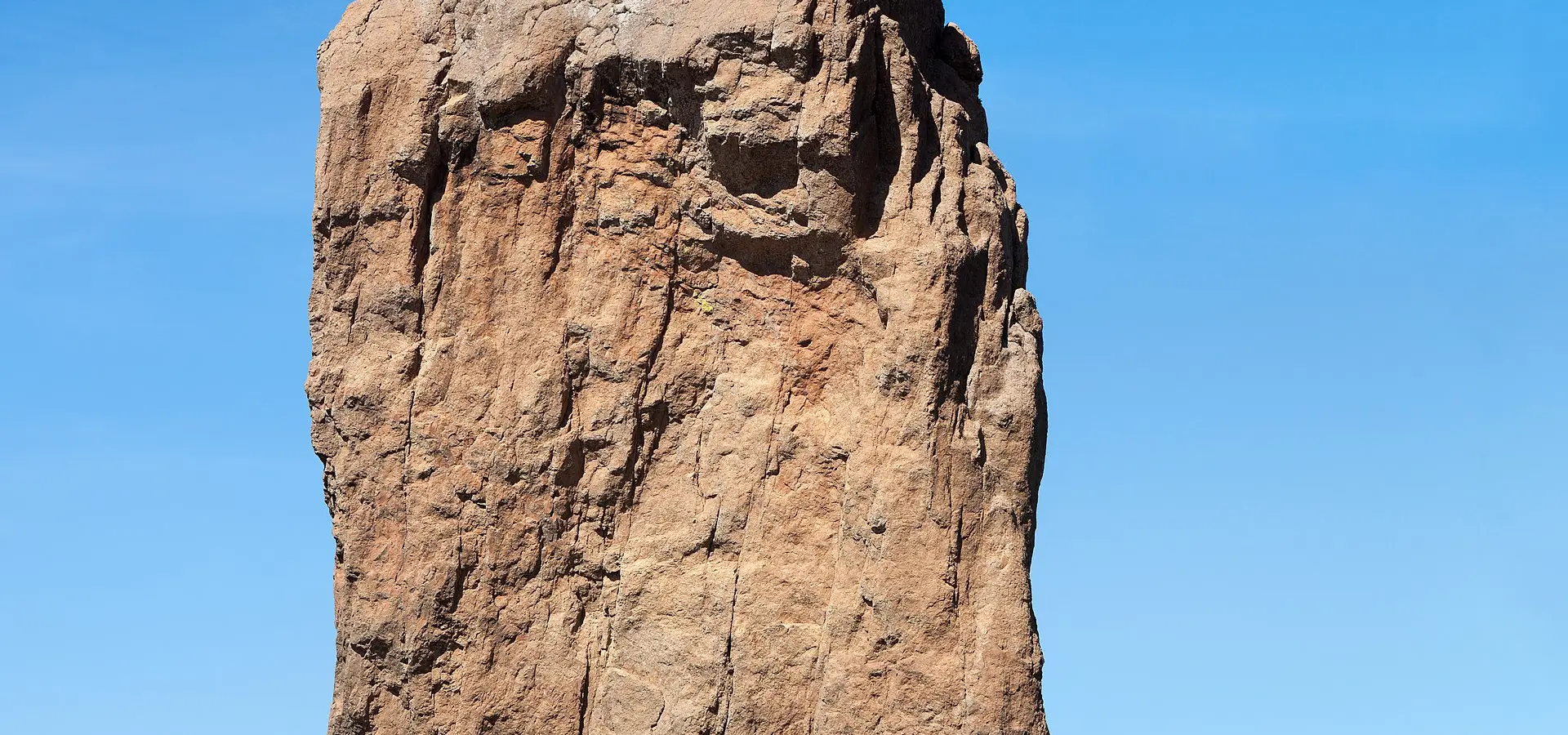
Roque Nublo is Gran Canaria's most iconic natural monument: an 80-metre basalt monolith rising above a sea of clouds like a volcanic sentinel. The Guanches (the pre-Hispanic inhabitants of the Canaries) considered it a sacred place and held ceremonies at its base. The access trail (30 minutes on foot from the GC-600 car park) offers views of Tenerife and Mount Teide to the west and the entire Gran Canarian summit.
The troglodyte villages of Gran Canaria are a singularity found nowhere else in western Europe. Artenara, the island's highest village (1,270 m), has houses carved into the volcanic rock (cave-dwellings) that have been continuously inhabited since pre-Hispanic times. The Mirador de la Atalaya restaurant, hollowed out of a cave, serves Canarian food with views across the island's entire centre. Tejeda, at the bottom of the caldera, is a white village with almond trees that bloom in February and has been declared one of the most beautiful villages in Spain.
Riding tips: Gran Canaria is accessible year-round thanks to its subtropical climate. The mountain roads in the interior are technical and narrow but well-surfaced. Watch out for fog on the summits. To bring your bike, take the ferry from Cádiz or Tenerife. Petrol stations are frequent on the coast, scarce at the summits (fill up before climbing). For dining, Canarian watercress stew, papas arrugás with mojo, Queso de Flor de Guía (set with thistle flower, like Extremadura's Torta del Casar) and almond sweets from Tejeda are essential.
Subtropical: accessible all year. Frequent fog on summits. Hot on the south coast.
Tourist traffic on the south coast. Low in the mountainous interior.
Frequent petrol stations on the coast. Scarce at summits: fill up before ascending.