La Gomera by motorcycle: the GM-1, Garajonay and Valle Gran Rey
Best Season
AEMET publishes no climate normals for La Gomera. The nearest reference for the south coast, Tenerife Sur (1981-2010), gives a January average high of 21.7 °C, an average low of 15.2 °C and 1.8 days of rain. Up on Garajonay it is a good deal colder and fog is common: pack warm layers even if it is hot at sea level.
Round La Gomera on the GM-1: Hermigua, Agulo, Vallehermoso and the Valle Gran Rey gorge, returning over the heights of Garajonay. Few kilometres and not a single straight.
Published on
Highlights
- 1GM-1: the winding road that circles the island
- 2Agulo, facing Teide
- 3Palmarejo viewpoint (César Manrique) above Valle Gran Rey
- 4Garajonay: laurel forest, World Heritage since 1986
About this route
La Gomera has no straights. The GM-1 leaves San Sebastián, crosses to the north of the island and links Hermigua, with its valley of banana plantations, and Agulo, a village of cobbled lanes perched above the sea that faces Teide on clear days and has belonged to Los Pueblos Más Bonitos de España since 2021.
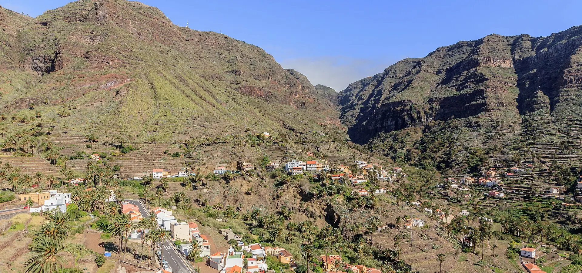
Vallehermoso lives in the shadow of Roque Cano, a volcanic natural monument that the municipality carries on its coat of arms. From there the GM-1 turns west and drops into the Valle Gran Rey gorge. On the way down, the Palmarejo viewpoint, designed by César Manrique, looks over the valley's sheer walls and palm groves; below, La Calera climbs the hillside.
The return runs along the island's spine on the GM-2, inside Garajonay National Park. A national park since 1981 and a UNESCO World Heritage Site since 1986, it holds the best-preserved laurel forest in the Canaries, a relic of the Tertiary that lives in the cloud belt. At Laguna Grande there is parking beside the road; the Degollada de Peraza gives the last view before the descent to San Sebastián.
It is only just over a hundred kilometres, but they are slow ones: the road is narrow, with one tight bend after another, and the summit is often inside the cloud that feeds the laurel forest, with damp tarmac and poor visibility even when the coast is sunny. To bring your own bike, the ferries between Los Cristianos (Tenerife) and San Sebastián carry vehicles.
Route stops
Hermigua
Village
Farming valley in the north, all terraces and banana plantations.
Agulo
Village
Cobbled old quarter with views of Teide; in Los Pueblos Más Bonitos de España since 2021.
Vallehermoso
Village
Village at the foot of Roque Cano, a natural monument.
Palmarejo viewpoint
Viewpoint
César Manrique viewpoint over the Valle Gran Rey gorge, right on the GM-1.
La Calera (Valle Gran Rey)
Village
One of the villages of Valle Gran Rey, on the slope above the mouth of the gorge.
Laguna Grande (Garajonay)
Viewpoint
Clearing in the heart of Garajonay National Park, with parking by the road.
Degollada de Peraza
Viewpoint
Pass on the GM-2, the last view before dropping down to San Sebastián.
Practical information
Weather
AEMET publishes no climate normals for La Gomera. The nearest reference for the south coast, Tenerife Sur (1981-2010), gives a January average high of 21.7 °C, an average low of 15.2 °C and 1.8 days of rain. Up on Garajonay it is a good deal colder and fog is common: pack warm layers even if it is hot at sea level.
Traffic
The Cabildo de La Gomera announces road closures for works on its website and social media (in October 2026 there were morning closures on the CV-14, El Rejo, which is not part of this route). Check them before setting off. The road is narrow: watch for buses and lorries on the tight bends.
Fuel stops
Fill up in San Sebastián before setting off. The loop is about 116 km of bends: one full tank is enough, but do not start on reserve.
Where to stay on this route
The towns this route passes through — useful for splitting it into stages or sleeping near the start. Book ahead in high season.
- HermiguaSee places to stay
- AguloSee places to stay
- VallehermosoSee places to stay
Affiliate links: if you book through them, Nomadiq earns a small commission at no extra cost to you.

