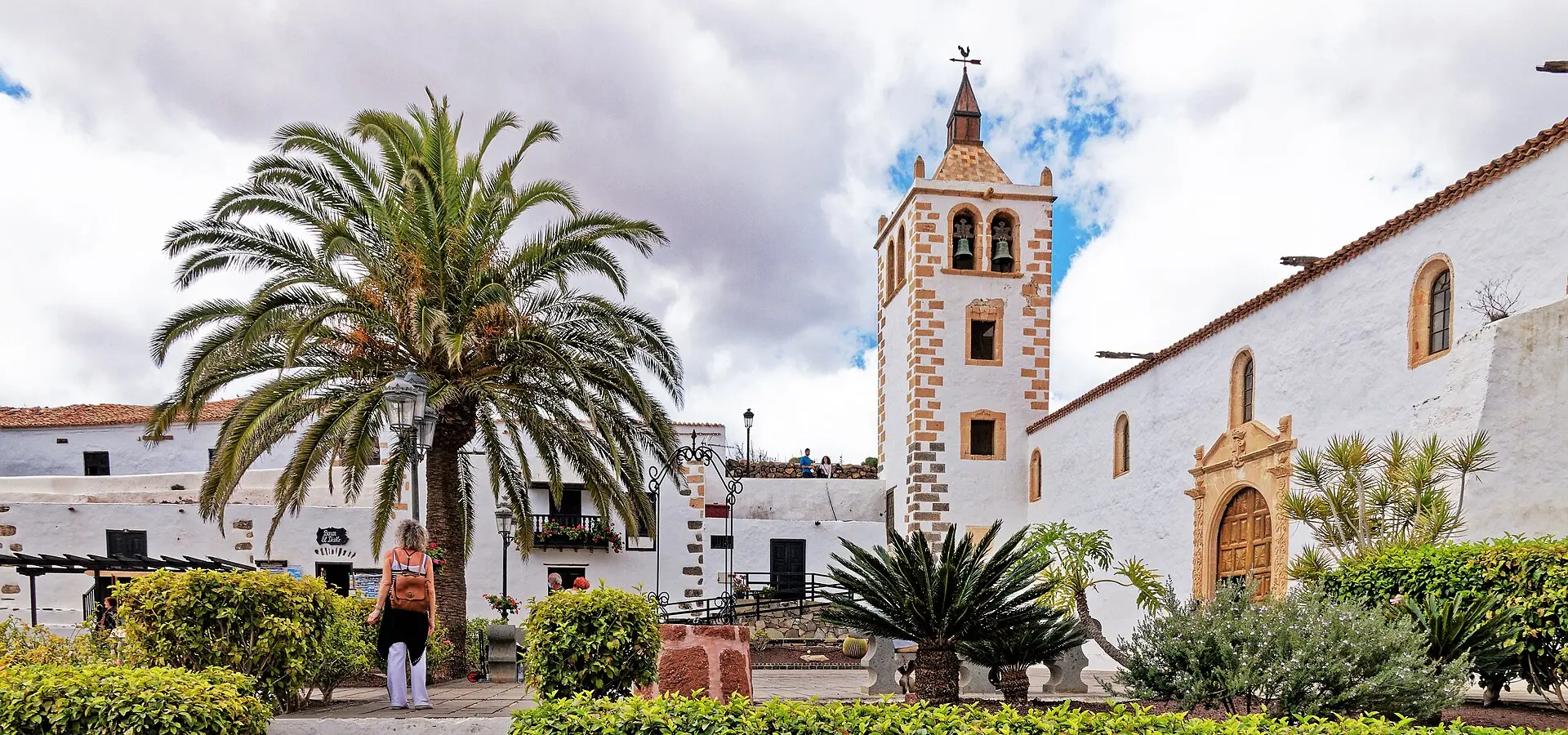
Fuerteventura by motorcycle: Betancuria, Pájara and the Ajuy caves
Best Season
AEMET normals (Fuerteventura airport, 1981-2010): in January, an average high of 20.6 °C, an average low of 14.7 °C, 14 mm and 2.5 days of rain. On the heights of the massif the wind comes in gusts: take care on the passes.
The FV-30 crosses the Betancuria massif: the Morro Velosa viewpoint, the island's old capital, Vega de Río Palmas, Pájara and the run down to the Ajuy caves, home to the oldest rocks in the Canaries.
Published on
Highlights
- 1FV-30: the winding road over the Betancuria massif
- 2Morro Velosa viewpoint (César Manrique)
- 3Betancuria, the island's capital until 1834
- 4Ajuy: sea caves and the oldest rocks in the Canaries
About this route
The FV-30 is Fuerteventura's mountain road. It leaves the plain in the middle of the island behind, climbs the Betancuria massif and zigzags down towards Pájara. At the top, the Morro Velosa viewpoint, designed by César Manrique, takes in the island's interior, a landscape of bare ridges and open valleys.
Betancuria was founded in 1404, during the Norman conquest led by Jean de Béthencourt and Gadifer de La Salle, and takes its name from the former; it was the capital of Fuerteventura until 1834. The church of Santa María presides over the village. A few kilometres south, at Vega de Río Palmas, stands the sanctuary of the Virgen de la Peña, the island's patron saint: an alabaster figure barely 21 centimetres tall.
In Pájara, the church of Nuestra Señora de Regla has a doorway carved with suns, serpents and big cats that many historians link to the art of the Americas. From the village the FV-621 runs down to Ajuy on the west coast. There, beside the beach, are the sea caves and, according to the Canary Islands tourist board, the oldest rocks in the archipelago: ocean-floor sediments between 100 and 150 million years old.
Back up on the FV-30, the route returns to Puerto del Rosario via Antigua, where a restored windmill beside the FV-20 recalls that gofio was once ground on this plain. It is the driest route in the series, with less winter rain than any of the other eight; what you need to watch is the wind.
Route stops
Morro Velosa viewpoint
Viewpoint
César Manrique viewpoint on the FV-30, overlooking the island's interior.
Betancuria
Village
Founded in 1404 and capital of Fuerteventura until 1834; church of Santa María.
Vega de Río Palmas
Village
Hamlet of Betancuria with the sanctuary of the Virgen de la Peña, patron saint of Fuerteventura.
Pájara
Village
Church of Nuestra Señora de Regla, with its doorway carved with suns, serpents and big cats.
Ajuy
Village
Coastal hamlet of Pájara; on foot from the beach, the caves and the oldest rocks in the Canaries.
Antigua
Village
Town on the central plain, with a restored windmill beside the FV-20.
Practical information
Weather
AEMET normals (Fuerteventura airport, 1981-2010): in January, an average high of 20.6 °C, an average low of 14.7 °C, 14 mm and 2.5 days of rain. On the heights of the massif the wind comes in gusts: take care on the passes.
Traffic
The FV-30 carries little traffic but has tight bends and some narrow sections. The run down to Ajuy (FV-621) is out and back: you have to climb back to Pájara. The Ajuy caves are reached on foot from the beach along a path; follow the signs.
Fuel stops
Fill up in Puerto del Rosario. It is about 115 km with no large towns on the massif: one full tank is enough.
Where to stay on this route
The towns this route passes through — useful for splitting it into stages or sleeping near the start. Book ahead in high season.
- BetancuriaSee places to stay
- Vega de Río PalmasSee places to stay
- PájaraSee places to stay
Affiliate links: if you book through them, Nomadiq earns a small commission at no extra cost to you.

