The Costa de la Luz by motorcycle: Vejer, Bolonia and Tarifa via La Janda
Best Season
AEMET normals (Cádiz, 1981-2010): mild lows (an average of 9.4 °C in January, no frost on the coast), but this is the wettest route in the series: 92 mm and 8.1 days of rain in December. Wind rules in the Strait: check the forecast before setting off, especially for the Tarifa stretch.
From Conil: the pine forest of La Breña, Zahara de los Atunes, the Roman ruins of Baelo Claudia and Tarifa, returning inland via Benalup-Casas Viejas, Medina Sidonia and Vejer.
Published on
Highlights
- 1The A-2233 through the La Breña pine forest
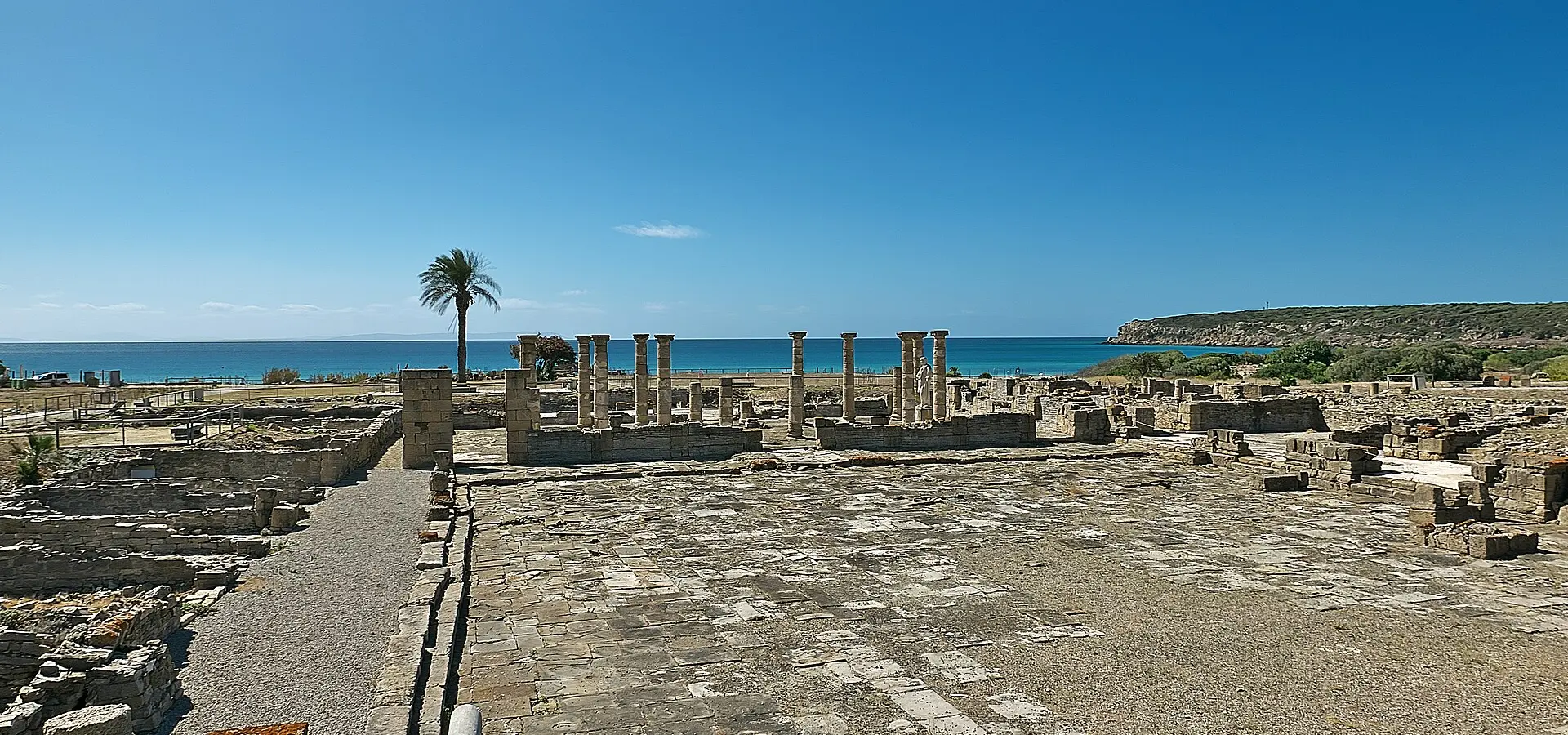
- 2Baelo Claudia, a Roman town beside Bolonia beach
- 3Tarifa, the southern tip of mainland Europe
- 4Vejer de la Frontera, a historic-artistic site
About this route
From Conil, the A-2233 runs towards Los Caños de Meca and Barbate through the La Breña y Marismas del Barbate Natural Park: pine forest on cliffs that rise to around a hundred metres above the sea. The Torre del Tajo, a late-16th-century watchtower, is reached on foot along the cliff path. Beyond Barbate, the coast continues to Zahara de los Atunes.
The ride down to Bolonia on the CA-8202 ends at the cove holding the ruins of Baelo Claudia, a Roman town with a forum, a basilica and fish-salting factories beside the beach. The archaeological site is run by the Junta de Andalucía and closes on Mondays. Further east, Tarifa has on the Isla de las Palomas the southernmost point of mainland Europe, some 14 kilometres from Africa.
The return runs inland. The N-340 heads north and the A-396 crosses La Janda to Benalup-Casas Viejas, whose municipality holds the Tajo de las Figuras cave, with rock paintings recorded in 1913 and closed to the public since 2008. Medina Sidonia crowns its hill with the church of Santa María la Coronada.
Vejer de la Frontera, a historic-artistic site since 1976, is the last stop: white houses, narrow lanes and the walled quarter, before the ride down to Conil. This is the wettest and windiest route in the series: pick your day with the forecast in hand.
Route stops
Los Caños de Meca
Village
Gateway to the La Breña y Marismas del Barbate Natural Park, on the A-2233.
Zahara de los Atunes
Village
Coastal village of Barbate, between Barbate town and the Bolonia cove.
Baelo Claudia (Bolonia)
Monument
Roman town beside the beach: forum, basilica and fish-salting factories. Closed on Mondays.
Tarifa
Village
The Isla de las Palomas marks the southernmost point of mainland Europe.
Benalup-Casas Viejas
Village
Its municipality holds the Tajo de las Figuras cave, with rock paintings (closed to the public).
Medina Sidonia
Village
Hilltop town crowned by the church of Santa María la Coronada.
Vejer de la Frontera
Village
Historic-artistic site since 1976, with its walled quarter.
Practical information
Weather
AEMET normals (Cádiz, 1981-2010): mild lows (an average of 9.4 °C in January, no frost on the coast), but this is the wettest route in the series: 92 mm and 8.1 days of rain in December. Wind rules in the Strait: check the forecast before setting off, especially for the Tarifa stretch.
Traffic
The N-340 between Vejer and Tarifa is the area's main road: lorry traffic and side gusts. The road down to Bolonia (CA-8202) is out and back. Baelo Claudia is closed on Mondays; check opening hours on the Junta de Andalucía website.
Fuel stops
It is about 229 km. Fill up in Conil before leaving and again in Tarifa or Barbate, the larger towns on the way.
Where to stay on this route
The towns this route passes through — useful for splitting it into stages or sleeping near the start. Book ahead in high season.
- Los Caños de MecaSee places to stay
- Zahara de los AtunesSee places to stay
- Baelo Claudia (Bolonia)See places to stay
Affiliate links: if you book through them, Nomadiq earns a small commission at no extra cost to you.

