

Motorcycle routes in Navarre 🇪🇸
5 routes available
- Routes
- 5
- km
- 785
- High point
- 1,430 m
Navarre is a crossroads: the Navarrese Pyrenees, the Irati forest, the semi-desert Bardenas Reales and the Ebro riverside. Variety and solitude for the riders who discover it.
Pyrenean passes in the north, secondary roads through the mid-Pyrenees and semi-desert straights in the Bardenas. Low traffic, good tarmac. Best from April to October.
The routes, highest first
Altitude · difficulty- Published routes
- 5From 97 to 200 km per route
- Total kilometres
- 785 km
- Average difficulty
- 3/5 · Moderate
- Best season
- April to October
- Highest elevation gain
- 2,300 mPeak altitude 1,430 m
- Routes with GPX
- 5 of 5
What riding Navarre is like
By road character: linked curves (4 routes), charming villages (4 routes), low traffic (3 routes), canyon (1 route), coastal (1 route), mountain pass (1 route), technical road (1 route).
The longest is Irati Forest and the Pyrenean Mountain Passes at 200 km; the shortest, Urederra Source and Urbasa-Andía Plateau at 97 km. The highest point is reached on Irati Forest and the Pyrenean Mountain Passes, at 1,430 m. The most demanding one rates 4 out of 5 for difficulty.
The season most of them share runs from April to October.
These routes pass through villages such as Elizondo, Zugarramurdi, Hondarribia, Ochagavía, and Arguedas. And stop at viewpoints such as Foz de Lumbier (el cañón, a pie), Nacedero del Urederra, Balcón de Pilatos, Selva de Irati, and Cabezo de Castildetierra.
Routes in Navarre

Navarre
Urederra Source and Urbasa-Andía Plateau
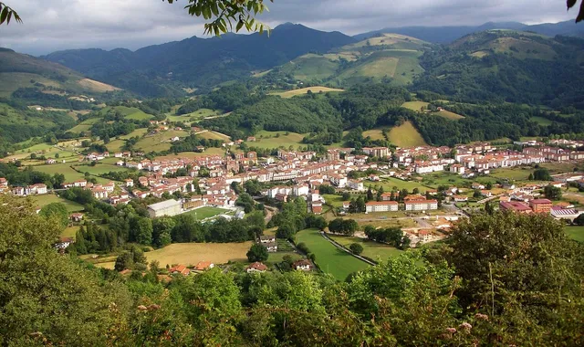
Navarre
Baztan Valley and French coast

Navarre
Lumbier Gorge and Leyre Mountains
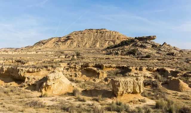
Navarre
Bardenas Reales: semi-desert landscape
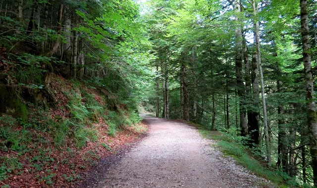
Navarre
Irati Forest and the Pyrenean Mountain Passes
Compare every route in Navarre
5 published routes in Navarre, 785 km in total. Each row shows the route's actual figures: distance, riding time, route type, surface, difficulty, cumulative ascent, best season and downloadable GPX track.
Scroll the table sideways to see every column.
| Route | Distance | Riding time | Type | Surface | Difficulty | Elevation gain | Best season | GPX |
|---|---|---|---|---|---|---|---|---|
| Urederra Source and Urbasa-Andía Plateau | 97 km | 3h 30min | Loop | Tarmac | 3/5 · Moderate | 1,430 m | April to October | Download |
| Baztan Valley and French coast | 180 km | 4h 30min | Loop | Tarmac | 3/5 · Moderate | 1,500 m | May to September | Download |
| Lumbier Gorge and Leyre Mountains | 138 km | 4h | Loop | Tarmac | 3/5 · Moderate | 1,530 m | April, May, June, September, October | Download |
| Bardenas Reales: semi-desert landscape | 170 km | 4h | Loop | Mixed | 3/5 · Moderate | 800 m | March, April, May, October, November | Download |
| Irati Forest and the Pyrenean Mountain Passes | 200 km | 5h | Loop | Tarmac | 4/5 · Hard | 2,300 m | May to October | Download |