Menorca by motorcycle: Monte Toro, Fornells and Cala Galdana
Best Season
AEMET normals (Menorca airport, 1981-2010): in January, an average high of 14.1 °C, an average low of 7.5 °C and 7.1 days of rain; in December, 8.8 days. This is the coolest and wettest route in the series. With a strong tramontana (north wind), Fornells and Monte Toro are very exposed. March and April are just as good.
Menorca east to west on back roads: from Maó to Ciutadella via Alaior, the top of Monte Toro, Fornells bay, Es Migjorn Gran, Ferreries and Cala Galdana.
Published on
Highlights
- 1Monte Toro, the roof of Menorca
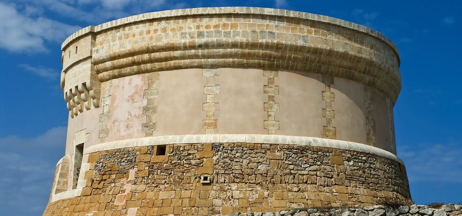
- 2Fornells bay and its defensive tower
- 3The Me-22 from Ferreries to Cala Galdana
- 4The whole island a Biosphere Reserve since 1993
About this route
The whole of Menorca has been a Biosphere Reserve since 1993, and you can cross it end to end in a morning. From Maó, the Me-1 leads to Alaior and Es Mercadal, at the foot of Monte Toro, the island's highest point. A narrow road climbs to the summit, home to the sanctuary of the Virgen del Toro, Menorca's patron saint.
From Es Mercadal, the Me-15 heads north to Fornells, a fishing village on an enclosed bay. On the headland stands the defensive tower built in the early 19th century, at the end of British rule, which has been open to visitors since 2000, after its restoration.
The way back south runs through Es Migjorn Gran, which split from Es Mercadal to become a municipality in its own right in 1989, and Ferreries, from where the Me-22 drops down a ravine-cut landscape to Cala Galdana. The Me-1 ends in Ciutadella, the old capital: the British governor Richard Kane moved the capital to Maó in the 18th century.
It is the quietest and least demanding route in the series: no passes, short roads and a village every few kilometres. On the other hand, in winter it is the coolest and the one with the most rainy days. To bring your bike, vehicle ferries run between Alcúdia (Mallorca) and Ciutadella.
Route stops
Alaior
Village
Town in the middle of the island, on the Me-1.
Es Mercadal
Village
At the foot of Monte Toro; the climb to the summit and the Me-15 to Fornells both start here.
Monte Toro, sanctuary of the Virgen del Toro
Viewpoint
Menorca's highest point, with the sanctuary of the island's patron saint.
Fornells
Village
Fishing village on an enclosed bay, with a defensive tower open to visitors.
Es Migjorn Gran
Village
A municipality in its own right since 1989, after splitting from Es Mercadal.
Ferreries
Village
Inland town from which the Me-22 runs down to Cala Galdana.
Cala Galdana
Viewpoint
Southern cove at the end of the Me-22, between ravines.
Practical information
Weather
AEMET normals (Menorca airport, 1981-2010): in January, an average high of 14.1 °C, an average low of 7.5 °C and 7.1 days of rain; in December, 8.8 days. This is the coolest and wettest route in the series. With a strong tramontana (north wind), Fornells and Monte Toro are very exposed. March and April are just as good.
Traffic
The road up Monte Toro is narrow and ends at a car park on the summit. The road to Cala Galdana from Ferreries is out and back. The Me-1 is the island's main road, busier than the back roads.
Fuel stops
It is about 95 km between Maó and Ciutadella, the island's two towns: no fuel planning needed.
Where to stay on this route
The towns this route passes through — useful for splitting it into stages or sleeping near the start. Book ahead in high season.
- AlaiorSee places to stay
- Es MercadalSee places to stay
- FornellsSee places to stay
Affiliate links: if you book through them, Nomadiq earns a small commission at no extra cost to you.

