![[object Object]](https://cdn.sanity.io/images/nbs5i7n6/production/1ece9b7a167b72ae6fa1dd61dedda9d5191577e1-1920x1280.jpg?rect=0%2C100%2C1920%2C1080&w=1920&h=1080&q=90&auto=format&fit=max&fm=webp&dl=)
Motorcycle routes in Extremadura 🇪🇸
3 routes available
Extremadura is Spain's least known and best kept region for riders. The Jerte Valley with its cherry blossom, Monfragüe National Park with its vultures, UNESCO-listed Cáceres, Trujillo of the conquistadors, Buñuel's Las Hurdes and the Sierra de Gata make up a territory whose authenticity and sheer emptiness have no rival in Western Europe.
Empty roads, well surfaced on the main axes and technical in the sierras. Very little traffic. Cheap fuel. Extreme heat on the plains in summer, cool in the mountains. Best seasons: spring, for the cherry blossom, and autumn.
- Published routes
- 3From 170 to 200 km per route
- Total kilometres
- 550 km
- Average difficulty
- 3/5 · Moderate
- Best season
- March, April, May, June, September, October
- Highest elevation gain
- 2,600 mPeak altitude 1,430 m
- Routes with GPX
- 3 of 3
What riding Extremadura is like
By road character: low traffic (3 routes), charming villages (3 routes), linked curves (1 route), technical road (1 route).
The longest is Monfragüe, Trujillo and Cáceres: Vultures, Conquistadors and UNESCO at 200 km; the shortest, Las Hurdes and Sierra de Gata: Spain's Most Remote Corner at 170 km. The highest point is reached on Las Hurdes and Sierra de Gata: Spain's Most Remote Corner, at 1,430 m. The most demanding one rates 4 out of 5 for difficulty.
The season most of them share runs from March, April, May, June, September, October.
These routes pass through villages such as Las Mestas, El Gasco, San Martín de Trevejo, Cabezuela del Valle, and Garganta la Olla. And stop at viewpoints such as Salto del Gitano (Monfragüe). They cross passes such as Puerto de Tornavacas (1.274 m).
Routes in Extremadura

Las Hurdes and Sierra de Gata: Spain's Most Remote Corner
Extremadura
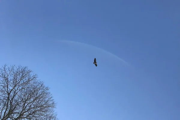
Monfragüe, Trujillo and Cáceres: Vultures, Conquistadors and UNESCO
Extremadura
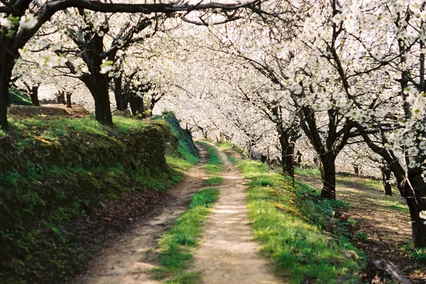
Jerte Valley and La Vera: Cherry Blossoms and Yuste Monastery
Extremadura
Take all 3 Extremadura routes as GPX
A single file with every track in the region, ready for your GPS or for Calimoto, Kurviger and Google Maps.
Free · No spam
Compare every route in Extremadura
3 published routes in Extremadura, 550 km in total. Each row shows the route's actual figures: distance, riding time, route type, surface, difficulty, cumulative ascent, best season and downloadable GPX track.
Scroll the table sideways to see every column.
| Route | Distance | Riding time | Type | Surface | Difficulty | Elevation gain | Best season | GPX |
|---|---|---|---|---|---|---|---|---|
| Las Hurdes and Sierra de Gata: Spain's Most Remote Corner | 170 km | 4h 30min | Loop | Mixed | 4/5 · Hard | 2,600 m | April, May, June, September, October | Download |
| Monfragüe, Trujillo and Cáceres: Vultures, Conquistadors and UNESCO | 200 km | 5h | Loop | Tarmac | 2/5 · Easy | 1,400 m | March, April, May, June, September, October, November | Download |
| Jerte Valley and La Vera: Cherry Blossoms and Yuste Monastery | 180 km | 4h 30min | Loop | Tarmac | 3/5 · Moderate | 2,200 m | March, April, May, June, September, October | Download |