
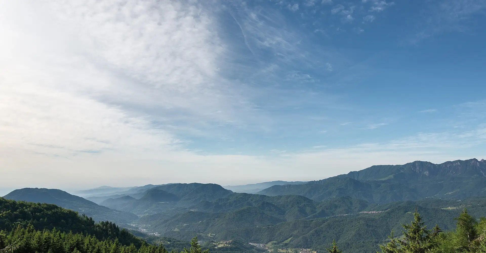
Road of the 52 Tunnels (Pasubio): the Great War Road
The Strada delle 52 Gallerie on Mount Pasubio is a First World War military road featuring 52 tunnels hand-dug into the rock. A route that combines military history, feats of engineering and the landscapes of the Venetian Pre-Alps.
Checking the route…
Roadbook
5 points- Start
Schio
Strada degli Eroi
Military access road to Mount Pasubio, featuring memorials.
MonumentRifugio Papa (1.928 m)
A mountain refuge with access to the Strada delle 52 Gallerie.
ViewpointRovereto
A town with a War Museum housed in a medieval castle.
Monument- Finish
Schio
Take the route to Google Maps
- Schio
- Strada degli Eroi
- Rifugio Papa (1.928 m)
- Rovereto
- Schio
We add waypoints from the GPX so Google Maps sticks to the route's roads (they show up as extra stops). To follow the exact track, use the GPX.
Highlights
- 0152 tunnels dug by hand during the First World War
- 02Military history: trenches and memorials on the Italian front
- 03150-million-year-old marine fossils on the tunnel walls
- 04The War Museum in Rovereto: one of the best in Europe
About this route
The Strada delle 52 Gallerie on Monte Pasubio is one of the most astonishing feats of military engineering from the First World War and an absolutely unique destination for motorcyclists in the Alps. Built by the Italian army in 1917 to supply the front-line positions on the summit of Monte Pasubio (1,928 m), this road climbs 800 metres in elevation through 52 tunnels hand-dug into the limestone of the Venetian Pre-Alps, many of which feature banked bends, steep gradients and sections where natural light barely penetrates.
The geology of Pasubio is that of the Venetian Pre-Alps: Jurassic and Cretaceous limestones and dolomites forming imposing vertical walls and elevated plateaux. The tunnels of the Strada cut through this hard limestone, and in many of them marine fossils (ammonites, belemnites, crinoids) are visible embedded in the walls: a fascinating superimposition of geological history (150 million years) and human history (100 years). The blue-grey rock of the tunnels contrasts with the vivid green of the beech and fir forests that cloak the mountainsides.
Motorised access to the Pasubio is via the Strada degli Eroi (Road of the Heroes), a converted military road that climbs from Valli del Pasubio to the Rifugio Papa. The Strada delle 52 Gallerie itself is a footpath (not suitable for vehicles), but the access road already offers extraordinary views of the Italian front during the Great War: restored trenches, artillery positions, ossuaries and memorials that serve as a reminder of the harshness of the Pasubio front, where nearly 10,000 Italian and Austro-Hungarian soldiers lost their lives, out of almost 100,000 combatants deployed in the area between 1915 and 1918.
Schio and Rovereto, the route’s main towns, offer a combination of military history and Venetian cuisine. The Museo Storico Italiano della Guerra in Rovereto is one of the finest museums in Europe dedicated to the Great War, housed in the town’s medieval castle. Local cuisine includes baccalà alla vicentina (Vicenza-style salt cod with polenta), bigoli con l’anara (thick pasta with duck ragù), sopressa vicentina (cured sausage) and Valpolicella and Soave wines from the nearby hills.
Practical riding info: the road to Rifugio Papa is open from May to October. The higher stretches are narrow with blind corners: ride with lights on and use your horn. The Strada delle 52 Gallerie (hiking trail) requires a torch and hiking boots; the full excursion takes 4–5 hours. For a purely motorcycle day, combine the climb to Pasubio with the road over the Pian delle Fugazze and the descent through the Valle dell'Agno. Fuel stations in Schio and Rovereto.
Practical information
Weather
Open May–October. Damp, cold tunnels: wear layers. Frequent fog at higher altitudes.
Traffic
Light traffic. Narrow road in the upper section. Frequent walkers.
Fuel stops
Petrol stations in Schio and Rovereto. None in the mountains.
Where to stay on this route
The towns this route passes through — useful for splitting it into stages or sleeping near the start. Book ahead in high season.
- Strada degli EroiSee places to stay
- RoveretoSee places to stay
- SchioSee places to stay
Affiliate links: if you book through them, Nomadiq earns a small commission at no extra cost to you.
Published on
Related routes
Dolomites and Italian Alps
Lake Garda: the Gardesana Occidentale
Dolomites and Italian Alps
Gavia Pass: the Wild Pass
Dolomites and Italian Alps
Mortirolo Pass: Cycling's Steepest Ramp
Dolomites and Italian Alps