Mejor Época
Port open June-October. Extremely cold at the top. Always wear a coat.
The Col de la Bonette (2,802 m), the highest asphalted road in Europe. From the Cians Gorges to the lunar summit, 2,400 m of ascent in a single climb. The ultimate biker experience.
Highlights
- 1Col de la Bonette (2,802 m): highest paved road in Europe
- 2Gorges du Cians: a canyon of blood-red rock
- 3Panoramic views from the Alps to the Mediterranean at the summit
- 4Marmots and mountain goats in the high alpine zone
About this route
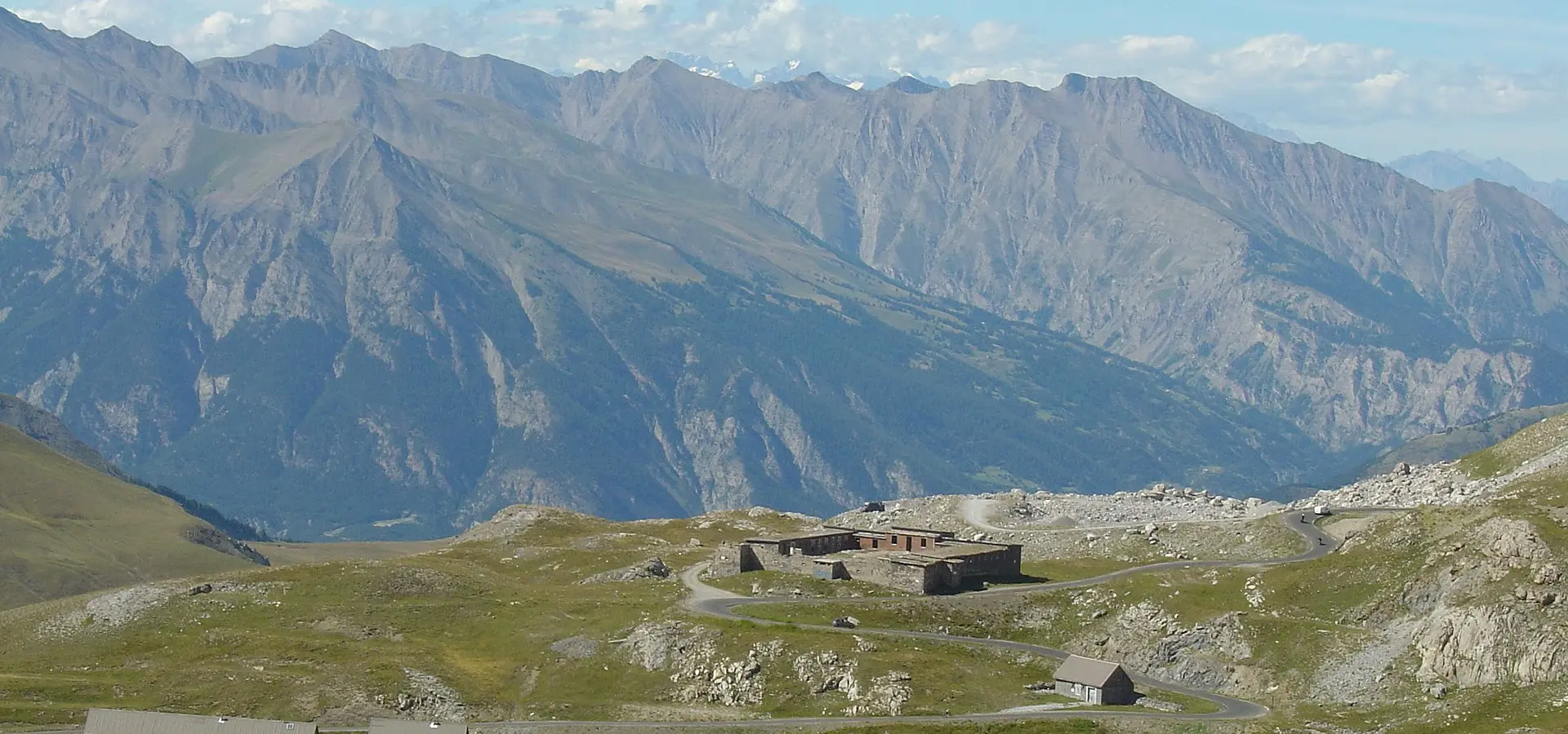
The Col de la Bonette holds a record that is hard to beat: at 2,802 meters above sea level (via the "resaut" loop that circles the summit), it is the highest paved road in all of Europe. It surpasses the Col de l'Iseran (2,770 m), Italy's Stelvio (2,757 m), and every other European alpine pass. Reaching the top by motorcycle — where a simple stone marker stands and a panorama stretches from the Alps to the Mediterranean — is one of the most intense and thrilling experiences a rider can have on the continent.
The classic ascent from the south, through the Gorges du Cians and the Tinée Valley from Nice, is a journey of astonishing contrasts. The Gorges du Cians is a river canyon carved through blood-red porphyry: the rock walls are literally red, as if painted, and the road threads through a series of narrow tunnels and tight bends at the edge of the abyss. It is one of the most spectacular and least known canyons in southeastern France.
From Saint-Étienne-de-Tinée, the D2205 begins its serious climb toward the Bonette. The road ascends relentlessly for over 40 km, passing through larch forests (which turn golden in October), alpine meadows dotted with marmots and mountain goats, and finally the barren high-mountain zone where only rock, residual snow, and sky remain. The altitude makes itself felt: above 2,000 m, naturally aspirated engines lose noticeable power, the air is markedly thinner and colder, and the final switchbacks demand concentration due to the lack of guardrails and exposure to wind.
The summit of the Bonette is a place of austere, otherworldly beauty: a grey stone desert at nearly 3,000 m altitude, with views that on clear days extend more than 200 km in every direction. To the north, the snow-capped peaks of the central Alps; to the south, the blue of the Mediterranean can be glimpsed. Temperatures at the top can be 20°C lower than in Nice (barely 90 km away), so warm clothing is absolutely essential even in the height of August.
Rider tips: the Bonette typically opens in mid-June and closes in late October (sometimes earlier if snow arrives early). The high-mountain section (above 2,000 m) can have residual snow and ice even in July. Fuel up in Saint-Sauveur-sur-Tinée or Jausiers (on the other side of the pass). For dining, in Saint-Étienne-de-Tinée the Auberge de l'Ours serves comforting alpine cuisine. And a critical tip: always carry warm layers, thick gloves, and a windbreaker, even if it is 30°C down below. The temperature difference between Nice (sea level) and the summit of the Bonette (2,802 m) can exceed 25°C. And do not attempt the climb if storms are forecast — lightning at the top of the Bonette is extremely dangerous and there is no shelter.
Practical information
Weather
Port open June-October. Extremely cold at the top. Always wear a coat.
Traffic
Low traffic. Some European bikers in summer.
Fuel stops
Petrol stations in Saint-Sauveur-sur-Tinée and Jausiers.